State Significant Development Overshadowing Impact Analysis for Apartment Proposal in Lindfield, Sydney NSW
State Significant Development (SSD) applications in Sydney often involve complex planning considerations, particularly where large-scale apartment developments interface with established low-density residential neighbourhoods. One of the most critical planning issues associated with these projects is overshadowing and the loss of solar access to adjoining residential properties.
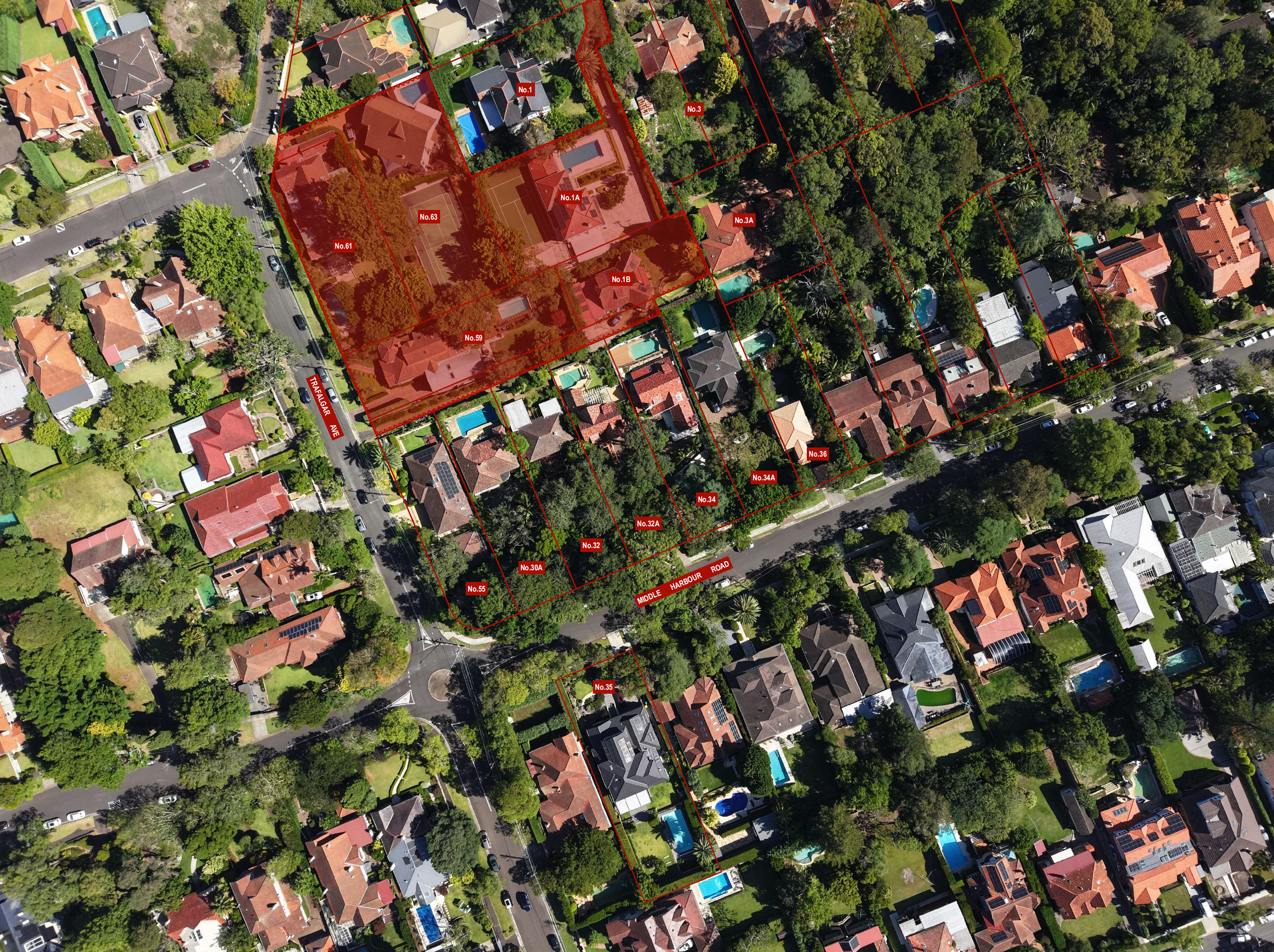
Recently, Shadow Diagrams was engaged by a collective of affected neighbouring property owners in Lindfield, NSW to undertake an independent overshadowing impact analysis associated with a proposed apartment development forming part of a State Significant Development application at 59–63 Trafalgar Avenue and 1A & 1B Valley Road, Lindfield NSW.
The neighbouring residents sought an independent technical assessment to better understand the potential impacts the proposed development could have on their homes, outdoor living areas and access to natural sunlight throughout the day during the winter solstice.
Independent Overshadowing Assessment for State Significant Development Applications
Unlike standard residential developments, State Significant Developments can involve substantially larger building envelopes and increased scale, often resulting in more pronounced overshadowing impacts on surrounding properties.
For this project, our role involved preparing a comprehensive comparative overshadowing assessment between the existing conditions and the proposed apartment development scheme. This included:
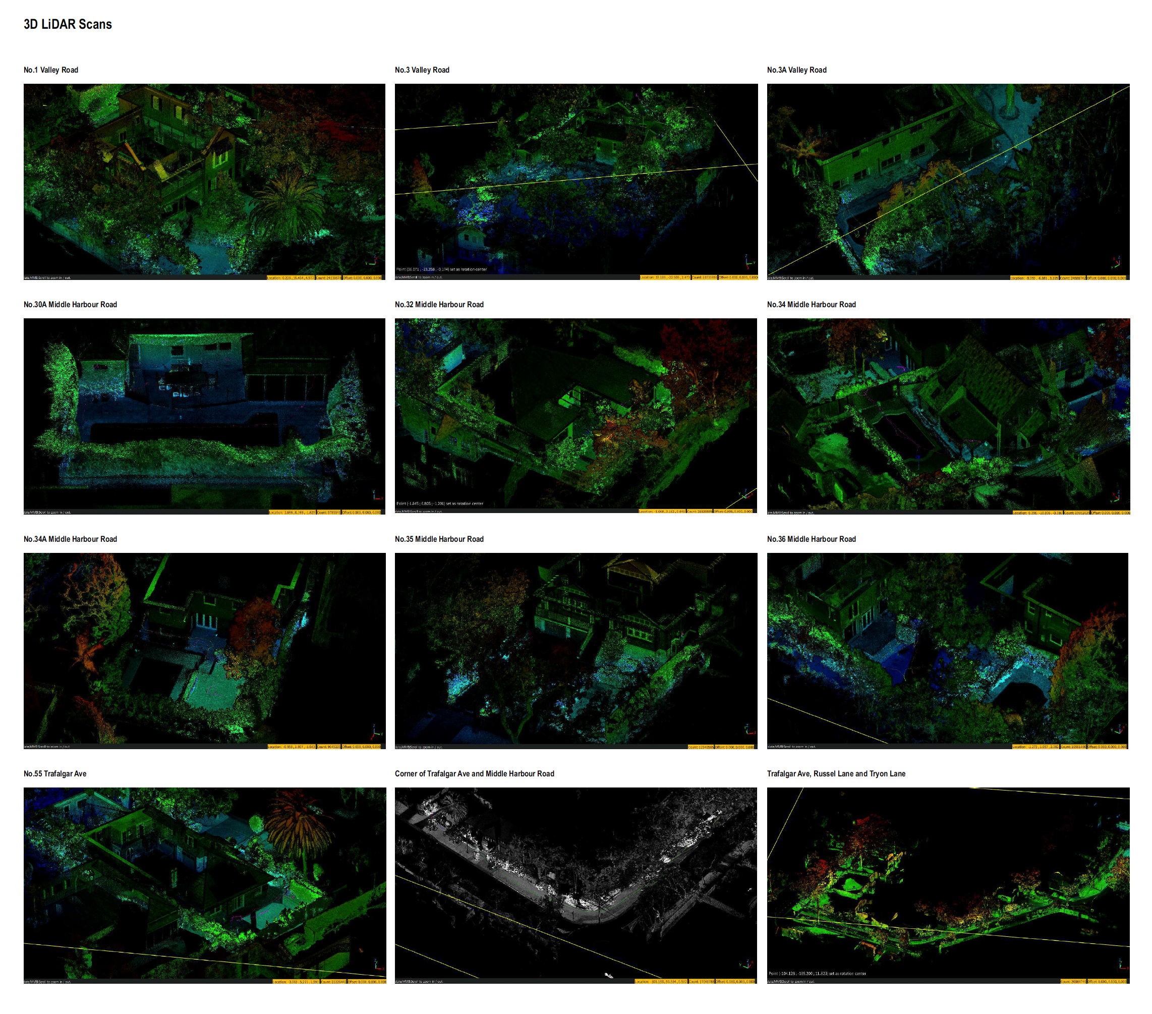
3D LiDAR scanning of adjoining properties
Detailed modelling of existing neighbouring dwellings
Modelling of the proposed apartment buildings
Comparative shadow analysis
Solar access assessment tables
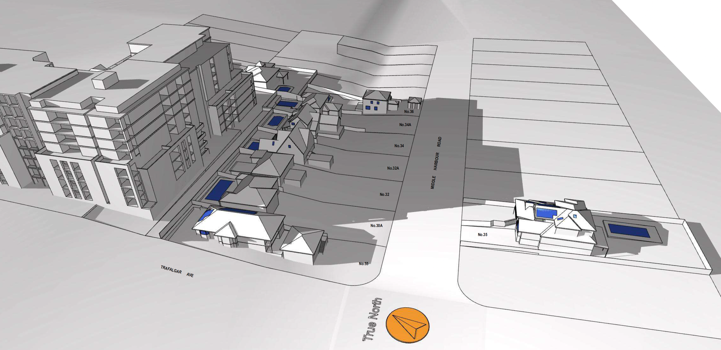
Bird’s-eye shadow studies
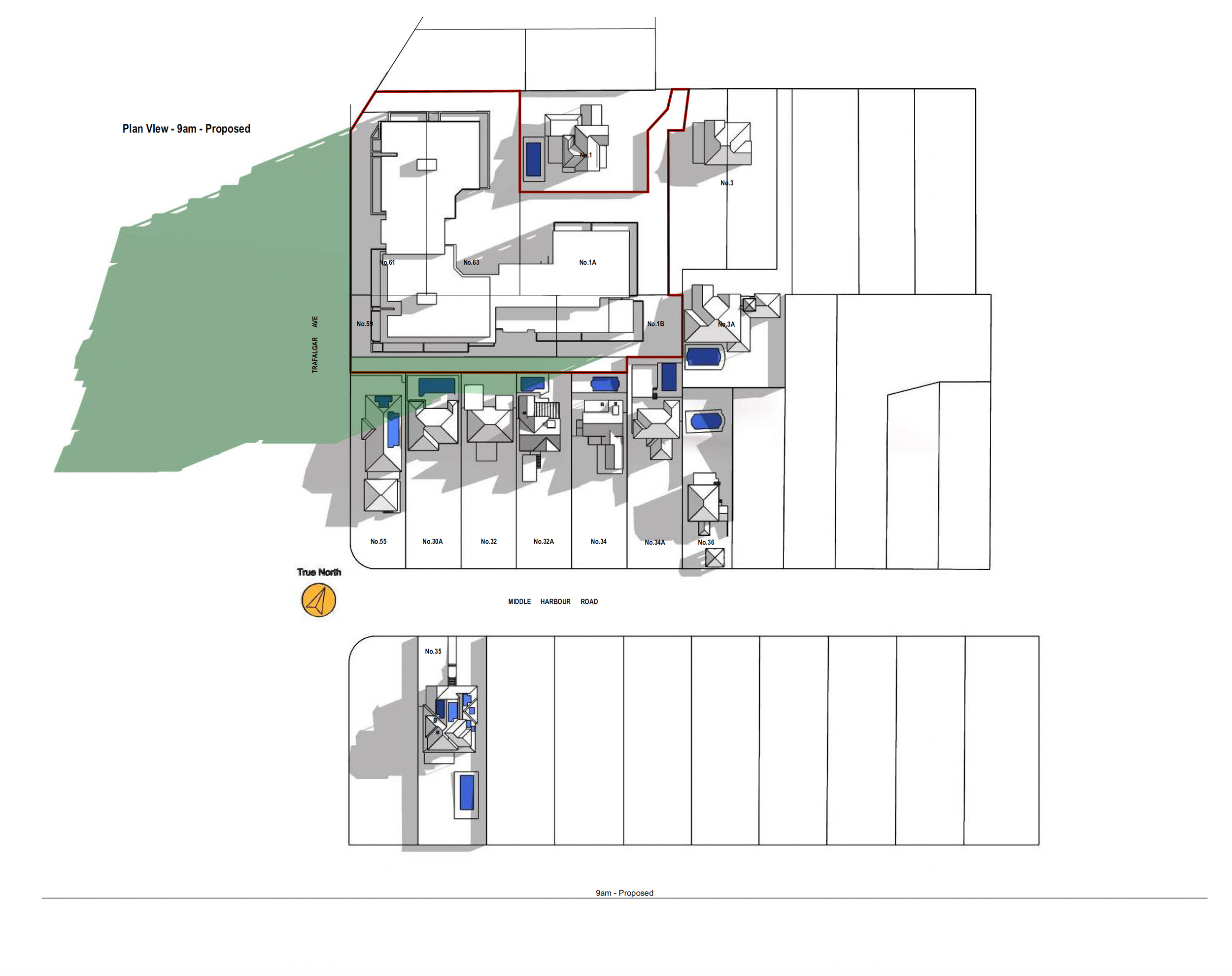
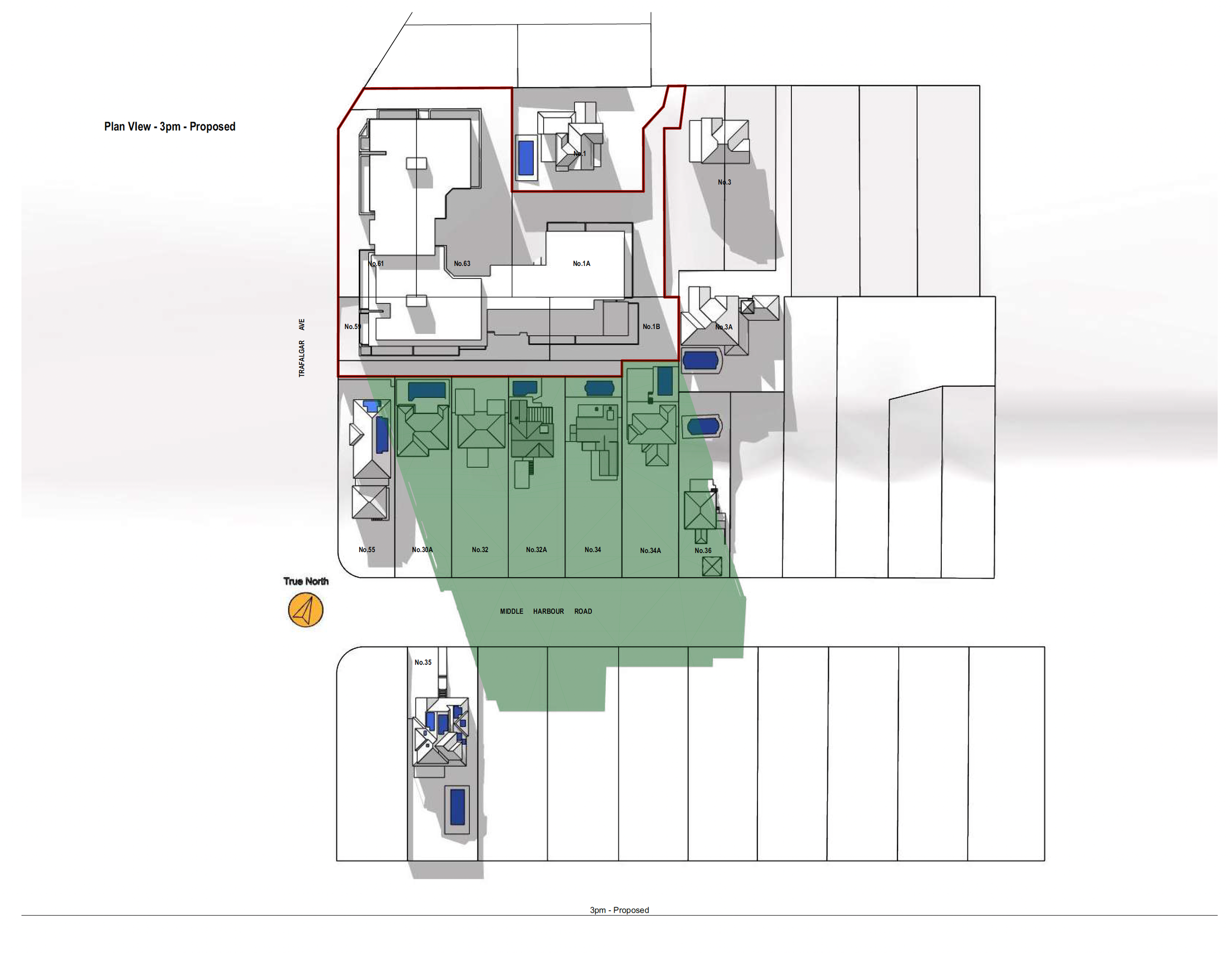
Hourly overshadowing diagrams from 9am to 3pm on 21 June
Visual analysis from adjoining residential properties
The assessment was prepared to assist affected neighbours in understanding the planning impacts associated with the proposed development and to support submissions within the SSD planning process.
Advanced LiDAR Scanning & 3D Context Modelling
One of the key challenges associated with overshadowing analysis for dense urban developments is obtaining accurate surrounding site information.
To improve modelling accuracy, Shadow Diagrams undertook extensive 3D LiDAR scanning of the surrounding neighbourhood and adjoining dwellings where available survey information was incomplete. The LiDAR scans captured detailed site geometry, roof forms, levels and surrounding built context to enable highly accurate shadow simulations.
The project incorporated surrounding residential properties along:
Trafalgar Avenue
Middle Harbour Road
Valley Road
Russell Lane
Tryon Lane
This allowed the overshadowing analysis to accurately assess the impact of the proposed apartment development on nearby habitable rooms, private open spaces and living areas.
Comparative Overshadowing Analysis of Existing vs Proposed Conditions
The shadow study compared existing and proposed overshadowing conditions at hourly intervals between 9:00am and 3:00pm on 21 June, which is the standard winter solstice assessment date used within NSW planning controls.
Both plan-view and bird’s-eye-view shadow diagrams were prepared to clearly illustrate the progression of overshadowing throughout the day and the extent of additional shadow cast by the proposed apartment buildings onto adjoining residential properties.
The analysis identified significant reductions in solar access to several adjoining southern properties under the proposed development scheme. According to the assessment summary, certain affected dwellings experienced substantial loss of sunlight during key solar access periods, with some habitable areas reduced to effectively zero hours of direct sunlight between 9am and 3pm on 21 June under the proposed conditions.
Importance of Independent Overshadowing Reports for Affected Neighbours
Independent overshadowing reports are becoming increasingly important for neighbouring residents impacted by large apartment and mixed-use developments throughout Sydney and NSW.
Many neighbouring property owners engage Shadow Diagrams to independently review proposed developments where concerns exist regarding:
Loss of solar access
Overshadowing of private open space
Impacts on habitable room windows
Reduced winter sunlight
Building bulk and scale
Visual privacy impacts
Compliance with apartment design guidelines
Planning proposal objections
State Significant Development submissions
Independent technical shadow studies can provide affected neighbours with objective, evidence-based analysis to better understand the planning impacts associated with proposed developments.
Overshadowing Reports for State Significant Development Projects Across NSW
Shadow Diagrams provides specialist overshadowing analysis and solar access assessments for:
State Significant Developments (SSD)
Apartment developments
Boarding houses
Mixed-use developments
Seniors living developments
Residential flat buildings
Childcare centres
Large-scale remedial projects
Planning objections and submissions
Land and Environment Court matters
Our services include:
2D and 3D shadow diagrams
LiDAR scanning
Solar access analysis
Photomontages
Visual impact assessments
Planning submission support
Independent peer review assessments
Need an Independent Overshadowing Assessment in Sydney or NSW?
If you are an affected neighbour, architect, planner, solicitor, strata committee or resident group seeking an independent overshadowing assessment for a proposed development in Sydney or NSW, Shadow Diagrams can assist with detailed and accurate solar access analysis.
Our team specialises in complex overshadowing studies involving apartment developments, State Significant Developments and high-density urban projects requiring accurate contextual modelling and detailed comparative analysis.
Visit Shadow Diagrams to learn more about our overshadowing assessment services across Sydney and New South Wales.